Postal Facts - U.S. Postal Service
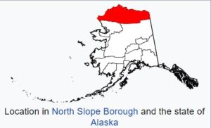
Largest ZIP
in continental U.S.
The largest ZIP Code in the continental U.S. is 99734, Prudhoe Bay, AK, which measures 30,683 square miles.
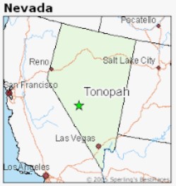
Largest ZIP
in contiguous U.S.
The largest ZIP Code in the contiguous U.S. is 89049, Tonopah, NV, at 10,821 square miles.
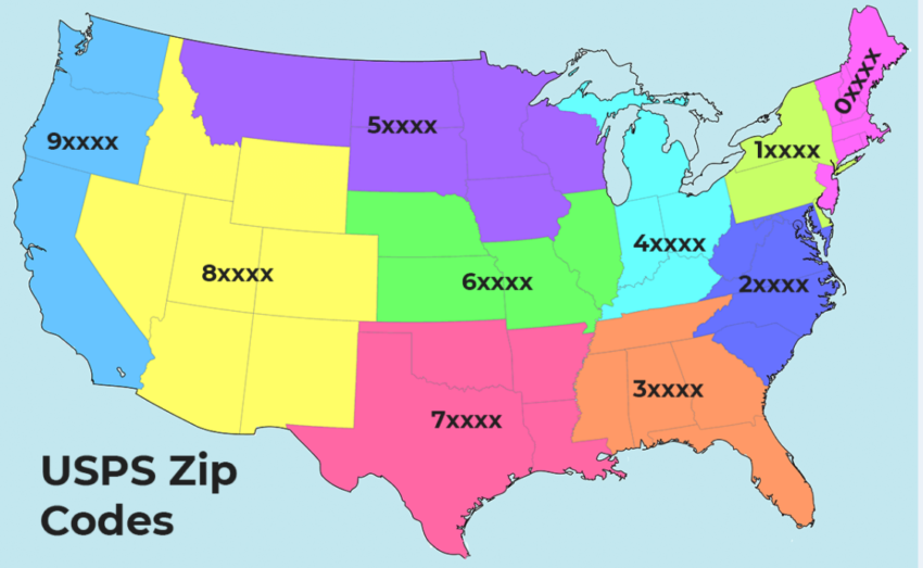
The Zoning Improvement Plan (ZIP) Code was launched in 1963 to better process and deliver increasing volumes of U.S. Mail. The first number in the five-digit ZIP Code represents a general geographic area of the nation, “0” in the east, moving to “9” in the west. The next two numbers represent regional areas, and the final two identify specific Post Offices. In 1983, the ZIP+4 Code was introduced.
USPS
Write badly?
We can still read it!
Chicken scratch. The Postal Service has an entire operation dedicated to deciphering poor penmanship.
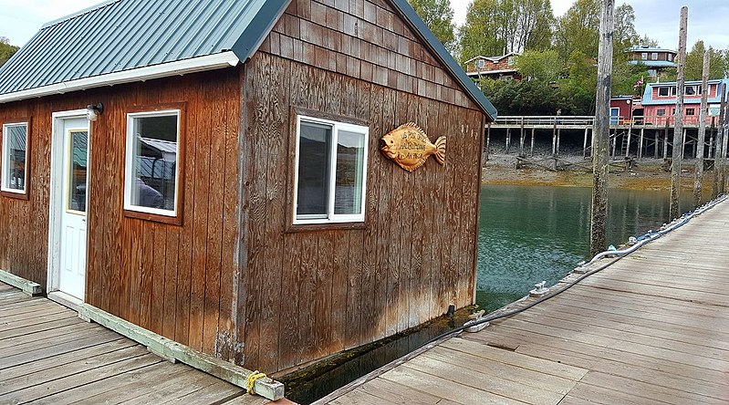
This Post Office floats! The Halibut Cove Post Office (99603) in Homer, AK, floats. The office is a small houseboat that is permanently tied to a dock.
6,604
addresses added daily
The Postal Service added an average of 6,604 addresses to its delivery network every day in 2024.
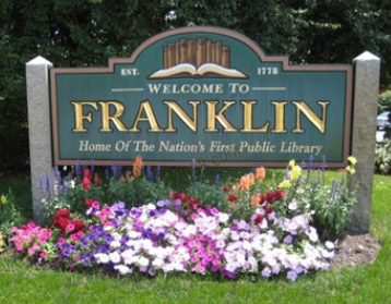
Ben, this one’s for you. There are 32 cities named “Franklin,” making it the most common city name. “Arlington,” “Clinton,” Springfield” and “Washington” are tied for second place at 29 locations each, while “Fairfield” and “Madison” tie for seventh place with 28 locations apiece. The most common Post Office name is “Clinton,” with 26 locations, followed by “Madison” at second (25) while “Franklin” and “Washington” are tied for third (24).
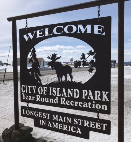
The longest Main Street in the country is located in Island Park, ID, and is 33 miles long.
The most common street name in the country is “Main” — 21,688 of them — followed by “Second” with 18,322, “Third” with 16,951 and “First” with 16,197.
There are 41,552 ZIP Codes in the country. They range from 00501, belonging to the Internal Revenue Service in Holtsville, NY, to 99950 in Ketchikan, AK. The easiest ZIP Code to remember? How about 12345, a unique ZIP Code for General Electric in Schenectady, NY.
116,628
deliveries from one office
The Post Office location with the most possible street deliveries is Heritage Station in San Antonio, TX (78245, 78250, 78251, 78253) — with 116,628 deliveries.
Our Post Office in Utqiagvik, North Slope of Alaska — formerly Barrow (99723) — experiences the coldest temperatures.
The shortest delivery route is rural route 012 in Woodinville, WA (98072). On this route, the carrier travels 2.45 miles and delivers to 1,147 boxes.
The longest delivery route is rural route 001 in Sidney, MT (59270) — 195.2 miles daily, delivering to 305 boxes.
12345
easiest to remember
The easiest to remember ZIP Code is 12345, a unique ZIP Code for General Electric in Schenectady, NY.
The highest numbered ZIP Code is 99950 in Ketchikan, AK.
The lowest ZIP Code number is 00501, unique for the Internal Revenue Service in Holtsville, NY.
The Hinsdale, NH, Post Office (03451) has been located in the same building since 1816.
The largest U.S. Postal Service retail space is the James A. Farley Post Office in New York, NY (10001), at 33,100 square feet.
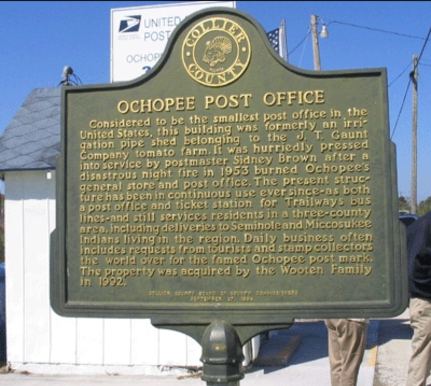
The smallest Post Office is located in Ochopee, FL (34141) and is 61.3 square feet. The building used to be a storage facility for irrigation pipes of an adjacent tomato farm. It was converted into a Post Office in 1953, after a fire that destroyed a previous Post Office and general store.
The most centered Post Office within the 48 contiguous states is located in Lebanon, KS.
MOST CENTRAL
Post Office of them all
The most centered Post Office within all 50 states is located in Belle Fourche, SD.
The northernmost Post Office location within the 50 states is in Utqiagvik, AK (formerly Barrow).
NORTHERNMOST
Post Office within 48 states
The northernmost Post Office location within the 48 contiguous states is in Angle Inlet, MN.
SOUTHERNMOST
within the 50 states
The southernmost Post Office location within the 50 states is located in Naalehu, HI.
SOUTHERNMOST
within 48 states
The southernmost Post Office location within the 48 contiguous states is located in Key West, FL.
EASTERNMOST
within the 50 states
The easternmost Post Office location in the 50 states is in Lubec, ME.
WESTERNMOST
within the 50 states
The westernmost Post Office location in the 50 states is in Gambell, AK.
WESTERNMOST
in the 48 contiguous states
The westernmost Post Office location in the 48 contiguous states is in La Push, WA.
The wettest Post Office is the Kapaa Post Office in Hawaii near Mt. Waialeale.
The lowest U.S. Post Office is located in Death Valley, CA (92328), at 282 feet below sea level. This is also the driest and hottest Post Office location.
The highest Post Office in the United States is located in Alma, CO (80420), at 10,578 feet above sea level.
Trademarks
The Sonic Eagle Logo, the trade dress of USPS packaging, the Letter Carrier Uniform and the Postal Truck and the following marks are among the many trademarks owned by the United States Postal Service: Click-N-Ship®, Deliver The Win®, EDDM®, ePostage®, Every Door Direct Mail®, Express Mail®, First-Class™, First-Class Mail®, First-Class Package International Service®, Forever®, Global Express Guaranteed®, IMb®, Informed Delivery®, Intelligent Mail®, Label Broker™, Parcel Select®, P.O. Box™, Post Office®, Pony Express®, Postal Inspection Service™, PostalOne!®, Postal Police®, #PostalProud®, Priority Mail Express International®, Priority Mail Flat Rate®, Priority Mail International®, Priority: You®, Registered Mail™, Standard Mail®, The Postal Store®, United States Postal Inspection Service®, United States Postal Service®, U.S. Mail®, U.S. Postal Inspector™, U.S. Postal Service®, USPS®, USPS BlueEarth®, USPS Mobile®, USPS Operation Santa®, USPS Tracking®, usps.com®, We are people delivering to people™, ZIP+4® and ZIP Code™. This is not a comprehensive list of all Postal Service trademarks.
Non-Postal Trademarks
Dollar General®, Forest Stewardship Council®, How2Recycle®, McDonald’s®, National Dog Bite Prevention Week®, Starbucks®, Subway®, Sustainable Forestry Initiative®, The Climate Registry®.
Postal Facts 2024 provides the public with information about the U.S. Postal Service. The facts in this publication may be reproduced for the purpose of stating the fact itself, in a business, informational or academic context and the like, and in the body of text discussing factual subject matter relevant to the fact being presented. However, these facts may become outdated after publication and seeking the latest information is advised.
Produced by U.S. Postal Service Corporate Communications
© 2024 United States Postal Service. All rights reserved.
facts.usps.com
© 2016-2026 United States Postal Service. All rights reserved.